


A city on a plateau
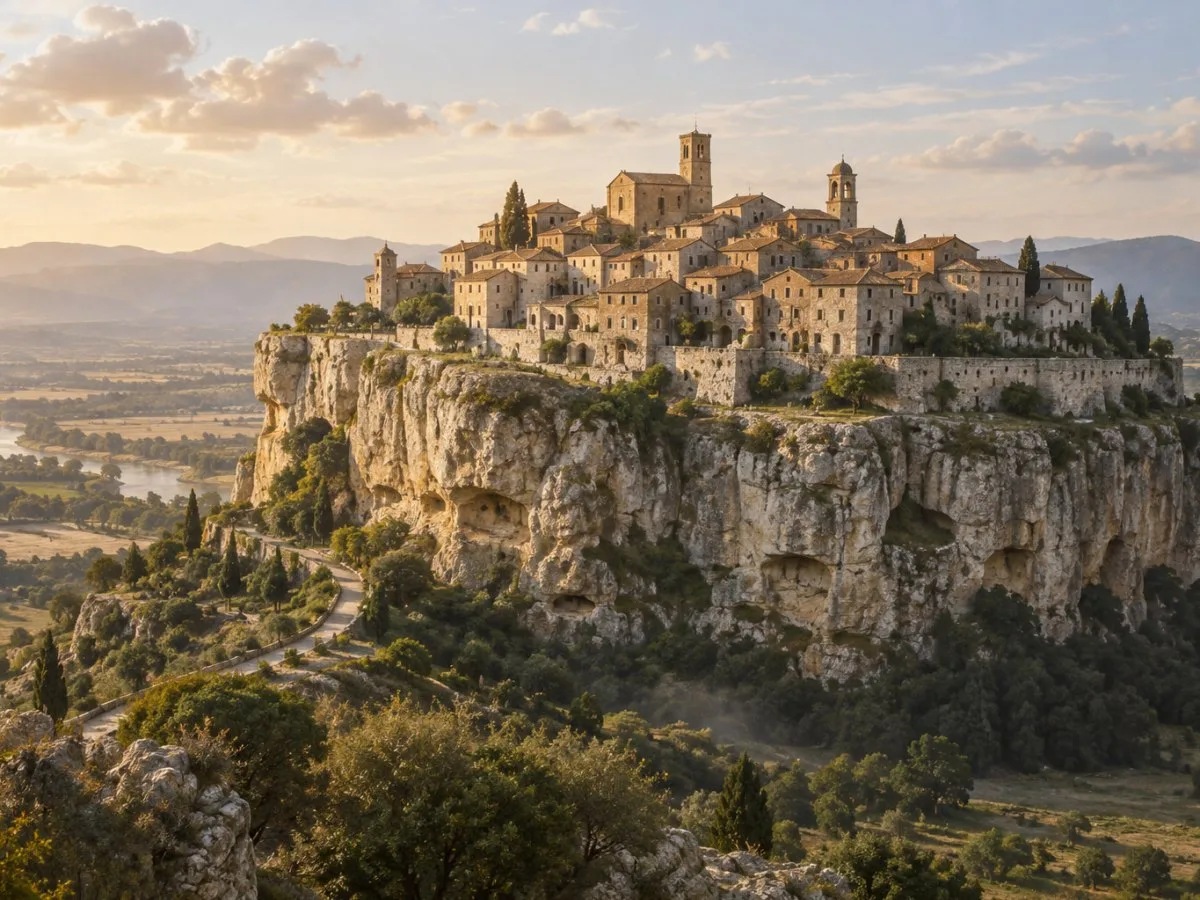
Orvieto stands on a natural plateau, atop a tufa cliff rising 150 metres above the surrounding plains. The topography shapes the urban outline: the city’s perimeter coincides with the edges of the platform.
The oldest traces of the Etruscan settlement date back to the ninth century BC. The Etruscan city reached its greatest development between the sixth and fourth centuries BC and declined during Roman times. In the Early Middle Ages, the strategic position of the cliff was once again appreciated. Around the year 1000, a new settlement developed, and in 1137 Orvieto became a free commune.
The city reached its maximum expansion between the thirteenth and fourteenth centuries. Since then, its urban structure has remained essentially intact, although buildings and architectural forms from later periods have been added to the fabric.
Axes, plazas and urban centres
The centre is organised along an east–west axis. Two other axes, perpendicular to the main one, lead to Piazza del Duomo and Piazza del Popolo, laid out together with their respective monuments. The square of Palazzo Comunale completes the group of prominent spaces in the old centre. This arrangement is described as functional polycentrism, rather than a city focused on a single point.
The layout can be read as a relationship between plazas, buildings and different centres of activity. This is an interpretation of its configuration; it does not imply that each space retains the same function it had in the past. As an urban scheme, it shows how several centres and monuments can structure a city without reducing it to a single main square.
The cathedral as an architectural landmark
The cathedral is dedicated to Santa Maria Assunta in Cielo. Construction began in 1290 at the behest of Pope Nicholas IV and continued for more than three centuries. Italy’s Tentative List submission dates the works to between the late thirteenth century and the first half of the fourteenth century, and notes that the building was erected over the remains of two earlier churches. The municipality also presents it as a symbol of the city.
The façade, conceived as a great triptych, is attributed to Lorenzo Maitani, who directed the works from 1310 to 1330, according to municipal information. The submission places his involvement in the early years of the fourteenth century. Mosaics on gold backgrounds cover the surfaces left free between the architectural elements and the bas-reliefs. At the base of the four spires, the bas-reliefs depict scenes from the Old and New Testaments; the mosaics narrate episodes from the life of Mary. The central rose window is attributed to Orcagna, identified by the municipality as Andrea di Cione: the submission dates it to 1354–1380, while the municipal page places it around 1354.
Inside, the sober-style space receives light from the rose window and a large Gothic stained-glass window behind the altar. Notable works include Gentile da Fabriano’s Madonna in trono con Bambino e Angeli and sculptures by Francesco Mochi. The Chapel of San Brizio houses a painted cycle begun by Beato Angelico and completed by Luca Signorelli between 1499 and 1504. The submission also names Benozzo Gozzoli and Perugino among the artists whose paintings it considers significant in the cathedral, without specifying their location. Architecture, mosaic, sculpture and painting help the cathedral stand out in the urban profile and shape the relationship between the building and the city.
Palaces and transformations around the Duomo
Around the cathedral are palaces associated with Popes Urban IV, Gregory X and Martin IV. Although they are now perceived as a single unit, their different typologies remain recognisable. Palazzo Soliano, associated with Boniface VIII, was built in step with the cathedral’s construction and eventually became part of its immediate setting.
Palazzo dell’Opera del Duomo was built in 1359 to house the administration of the cathedral works. Next to it, Palazzo Faina reused the structure of the medieval Palazzo Monaldeschi and now houses the Archaeological Museum. In the sixteenth century, the area was reorganised to give the Duomo more space and prominence.
The renewal also reached other parts of the city. During the sixteenth century, churches and palaces were built with the involvement of Michele Sammicheli, Antonio da Sangallo il Giovane, Simone Mosca, Raffaello da Montelupo and Ippolito Scalza. In the nineteenth century, Neoclassical buildings associated with Giuseppe Valadier and Virginio Vespignani were added. The variety of styles on the façades thus coexists with an urban structure that, in essence, retained its earlier form.
The underground as part of the architecture
The plateau contains numerous man-made cavities excavated as the city developed. Some served as quarries for tufa, travertine, sand and pozzolana, materials used first in Etruscan construction and later in medieval and Renaissance buildings. Others were used to collect, draw, store and distribute water; they also served to store grain or shelter animals.
Documented uses include rope-making, kilns, pottery workshops, cellars and oil mills. Also mentioned are the butti, cavities used as rubbish dumps from the Middle Ages onward. These functions broaden the idea of architecture: beyond façades and plazas, the underground formed part of activities involving extraction, storage and work.
Orvieto’s underground also includes wells and cisterns from different periods. In the Etruscan city, wells were used to seek groundwater and cisterns to collect rainwater. Tunnels could also channel water. These infrastructures show how access to water, shaped by the city’s location, gave rise to spaces excavated beneath the surface.
The Pozzo di San Patrizio: two spiral routes
The history of the Pozzo di San Patrizio links the monument’s form to the need to secure the water supply. After the Sack of Rome in 1527, Pope Clement VII commissioned the well for Orvieto’s fortress, with the specific purpose of guaranteeing the water supply if the city were besieged. The project was entrusted to Antonio da Sangallo il Giovane.
The design brings together two independent spiral staircases around a central shaft. One allowed pack animals to descend to draw water and return up the other, without obstructing traffic moving in the opposite direction. The well’s history records a depth of 53 metres and 248 steps on each staircase. The submission describes a cylinder 53.15 metres deep, excavated partly in the rock and built partly of brick, with windows to provide air and light.
Work began in 1527 at Clement VII’s commission. The pope died in 1534 before the well was complete; his successor, Paul III, brought construction to completion in 1537. The work brings together a circulation solution, construction and water management: an architectural response to an urban need.
Reading Orvieto through its layers
The topography marks the physical boundary; the axes and plazas organise the centre; the cathedral stands out within the ensemble; and the cavities extend spaces for extraction, storage and work underground. The well adds another scale: that of a structure designed to access water and facilitate the passage of pack animals through independent routes.
Italy’s proposal for Orvieto was submitted to the Tentative List on 1 June 2006. Inclusion on a Tentative List is not the same as inscription on the World Heritage List. This description offers a way to explore the relationships between topography, layout and architecture, but it is not a current assessment of conservation conditions or a description of a visit.
At a glance
Scope
Editorial reading; this is neither a visit nor a technical assessment.
Sources and references
Orvieto - UNESCO World Heritage Centre ↗26/10/2026 UNESCO World Heritage Centre, “Orvieto”, Italy’s Tentative List; submission date: 1 June 2006.
UNESCO - Search - UNESCO World Heritage Center ↗26/10/2026
Italy - UNESCO World Heritage Convention ↗26/10/2026
Il Duomo di Orvieto ↗11/11/2026 Comune di Orvieto, “Il Duomo di Orvieto”.
Orvieto Città viva Esperienza autentica ↗11/11/2026
"Tra storia e storie", Orvieto si racconta lungo l'Anello della Rupe - Comune di Orvieto ↗11/11/2026
Come arrivare - Mobilità - Comune di Orvieto ↗11/11/2026
Al via i lavori di riqualificazione dell'area verde di San Giovenale - Comune di Orvieto ↗11/11/2026
History of St Patrick's Well, Orvieto: Origins & Legend ↗12/11/2026 “History of St Patrick’s Well, Orvieto: Origins & Legend”.
La Storia – Orvieto Underground ↗12/11/2026 “La Storia – Orvieto Underground”.
I ritrovamenti medievali - Pozzo della Cava - Complesso archeologico in Orvieto ↗12/11/2026
The origins - Duomo di Orvieto ↗12/11/2026