



A city built through proximity
Ouadane, Chinguetti, Tichitt, and Oualata were founded in the 11th and 12th centuries on the southern edge of the Sahara. They grew in connection with the caravan routes that crossed the desert and, between the 12th and 16th centuries, became stages linking North Africa, the river regions of West Africa, and the savanna zone. Trade and religious life made them centres of Islamic culture.
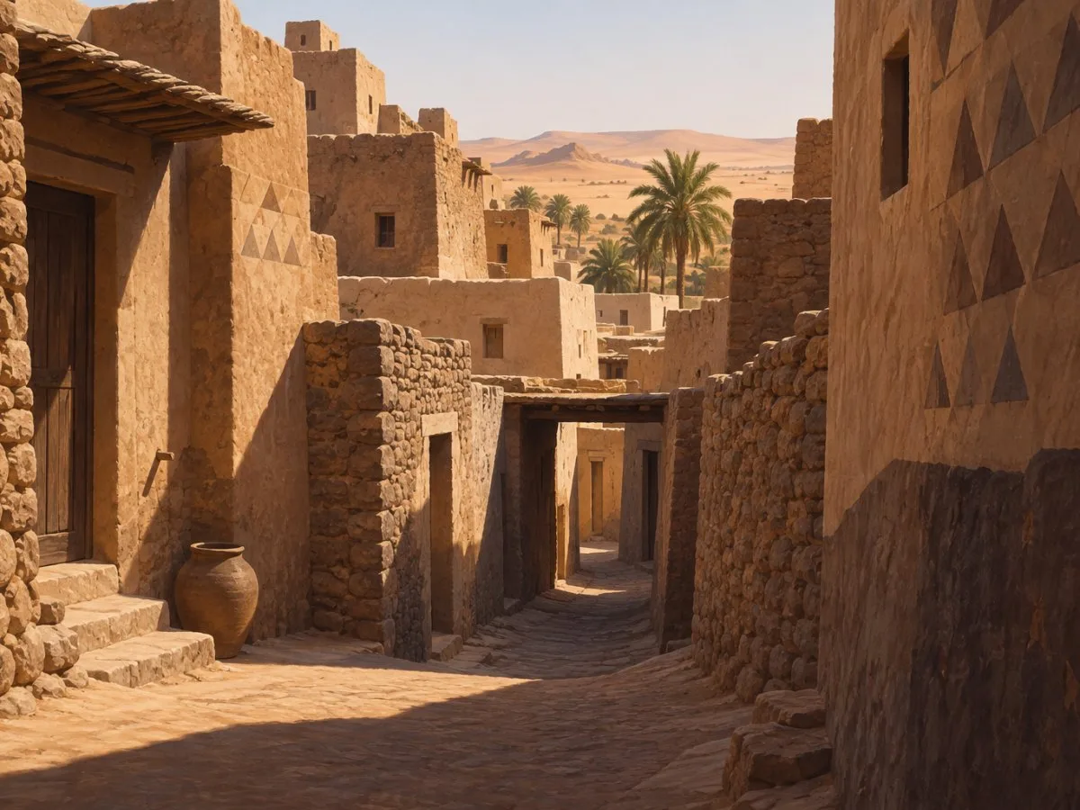
Their urban significance lies not only in individual buildings. The four settlements retain compact groups of homes, narrow winding streets, mosques, and other communal spaces. The urban fabric adapts to uneven ground: buildings cluster across changes in elevation, with terraces, bends, and unexpected passages. Farther from the centre, houses and courtyards tend to be more widely spaced, forming smaller clusters.
The density and shape of the routes suggest a city built up through layers of relationships, rather than organised around large squares or avenues. Open spaces are scarce, and public squares are scarcely described, even in front of the mosques. Covered passages, known as dhouleyla, and dead-end alleys create shaded areas.
An architecture of walls and courtyards
Traditional homes described in these ksour are usually single-storey, built from stone, clay, and wood. Many are arranged around a central courtyard and consist of a walled enclosure with small buildings of one or two rooms. Thick walls and few openings onto the exterior give many buildings a defensive character.
Facades may have ventilation openings, small windows, or low doors, as well as narrow openings. Some entrances are protected by toothed doors and receive ornamental treatment. In Oualata, geometric patterns on walls are connected with designs also found in other Mauritanian art forms, including jewellery, leatherwork and woodwork, embroidery, and carpets.
Inside homes, rooms do not necessarily have fixed uses. Their purpose changes with the season and time of day; roofs are also used as terraces. This flexibility is associated with a way of life in which homes could be occupied seasonally, though it should not be understood as a uniform rule for all households today.
Mosques are recognisable landmarks in the urban fabric. They are described as austere buildings, with a square minaret of thick walls and a prayer hall covered by a vaulted roof supported by sturdy columns. Nearby, mahadras—social and educational institutions—are arranged around open courtyards. Manuscript libraries, cemeteries, and mausoleums are also part of the ensemble.
Urban space responds to climate and terrain
Narrow, winding alleys follow rocky or sandy terrain. The combination of walls, covered passages, and crooked routes creates areas protected from the sun and offers a different spatial experience from a city laid out with straight streets and open spaces. The heritage description relates this urban form to the desert’s extreme climatic conditions, as well as to construction methods, ways of occupying space, and agricultural practices.
At the edges, walls, fences, or dense bands of housing marked the boundary between the old ksar and newer districts. Access routes linked each settlement to the outside and could lead to caravan routes, a well, a palm grove, or a cemetery. The relationship between centre, periphery, and landscape is therefore expressed not only in views, but also in the routes and activities that connect the city with its surroundings.
Palm groves, water, and shared work
Chinguetti, Ouadane, and Tichitt have palm groves. In Ouadane, old walls marked out agricultural plots called zeribas. The Echeylal irrigation system includes wells, pools, and channels; some traditional wells use a lever mechanism, while others are more recent concrete structures. The heritage description notes that the alluvial water table has been weakened by recent years of drought and that migration to urban centres has reduced the workforce available to maintain the system.
Palm groves are also social spaces. Guetna, the date-harvest season, brings city residents together around them. The forms of cooperation described include shared work to repair roofs or dig wells, as well as making strips of cloth for travelling tents. These activities show how the productive landscape and urban life are connected through work, celebrations, and knowledge passed down over time.
Living tradition and changing homes
The heritage of the ksour includes not only building forms, but also cultural practices and expressions. Oualata’s decorative motifs, for example, appear across different crafts and objects. In Chinguetti and Tichitt, music and compositions associated with caravan life form part of the cultural memory described for these cities.
Homes, however, are not static objects. Some ruined old houses have been rebuilt by their residents. Restorations have been documented that radically changed the layout and adopted more modern models, creating a break with the traditional housing type. Conservation work on site is also mentioned. The challenge is to recognise that urban continuity depends on preserving materials and forms, as well as on the uses, needs, and decisions of the people who live there.
Viewing these settlements as systems—houses, mosques, alleys, palm groves, water, and everyday practices—makes their architecture easier to understand. The courtyard is not separate from the street; the alley connects to routes and fields; and the palm grove brings together infrastructure, work, and social life. Much of the ksour’s character lies in these interdependencies.
At a glance
Scope
Editorial reading; it does not constitute a site visit or a technical assessment.
Sources and references
UNESCO Urban Heritage Atlas: Cultural mapping of historic cities and settlements| Ancient ksour of Ouadane, Chinguetti, Tichitt and Oualata (Mauritania) ↗30/10/2026 UNESCO World Heritage Centre, Ancient Ksour of Ouadane, Chinguetti, Tichitt and Oualata (Mauritania).
UNESCO Urban Heritage Atlas: Cultural mapping for historic cities and settlements ↗30/10/2026 UNESCO World Heritage Centre, UNESCO Urban Heritage Atlas: Cultural mapping for historic cities and settlements.
Explore the UNESCO Urban Heritage Atlas ↗30/10/2026 UNESCO World Heritage Centre, Explore the UNESCO Urban Heritage Atlas.