




From plan to lived space
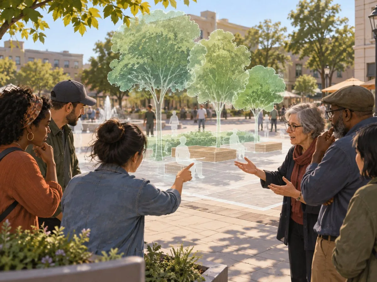
An urban proposal is often presented as a plan, model or image. Mixed reality offers another way to see it: combining the physical surroundings with digital elements to represent how a space might look after an intervention. Using a phone or glasses, for example, someone could view an architectural model placed in its real-world context before it is built.
This idea is especially relevant to streets, plazas and neighbourhoods, where design decisions affect everyday routines. A representation situated in its surroundings can help residents, planners, architects and other participants interpret a project through a shared reference point, rather than relying only on specialized drawings. It can also make designs easier to understand for people who find plans difficult to visualize.
That does not mean a visualization can precisely predict the experience of a finished place. It makes a proposal visible and allows people to examine, discuss and revise it; it does not replace the built space or, by itself, answer questions about how that space will be used in the future.
A tool within a participatory process
Mixed reality has been explored as a complement to urban participation methods, including Block by Block, a UN-Habitat initiative that uses Minecraft to let people develop design proposals for public spaces. In this approach, the game lets participants build and modify virtual landscapes; mixed reality can add another way to relate those ideas to the existing physical environment.
The potential contribution is not just technological. An immersive image can support discussion of alternatives, but participation also requires that people can raise needs, that their proposals are considered, and that there is an understandable connection between what they contribute and subsequent decisions. If the technology takes centre stage while community voices are pushed into the background, a visualization may be appealing without making the process more inclusive.
Nor does inclusion follow automatically from making a model easy to see. It is worth asking who can access the experience, what formats are used to present the project, and what other ways to participate are available. The digital divide, accessibility and the representation of groups that often have less influence are central concerns when digital tools are introduced into planning.
What a representation can and cannot show
Seeing a proposal overlaid on an existing place can help people notice how it relates to what is already there and express reactions before construction. This can open a more concrete conversation than an abstract image sometimes allows. But the representation remains one version of the project: on its own, it does not demonstrate how the project will function, how different people will perceive it, or what effects it will have on everyday life.
It is therefore useful to distinguish three levels:
- What is represented: the digital design and its visual relationship to the place.
- What can be discussed: the preferences, concerns and alternatives people express as they view it.
- What still requires other tests or decisions: the feasibility of the intervention, its implementation and its effects once built.
This distinction prevents a visual experience from being confused with a complete evaluation. It also helps position mixed reality as a resource for discussion and revision, not as a guarantee of consensus or good outcomes.
The decisive question: who participates, and what changes?
The people-centred smart cities approach emphasizes that technologies should respond to real needs, respect rights and broaden participation. Applied to urban design, this shifts the question from “What can the tool show?” to “Who can influence the project, and how are their contributions incorporated?”
A digital representation can help make a proposal easier to understand; its public value, however, depends on how it fits into a broader process. Mixed reality offers a way to imagine changes to streets and everyday spaces collectively. For that imagining to have consequences, participants must be able to do more than look at the model.
At a glance
Scope
Editorial reading; it is not a site visit or a technical assessment.
Sources and references
Mixed reality for public participation in urban and public space design - Towards a new way of crowdsourcing more inclusive smart cities | UN-Habitat ↗26/10/2026 UN-Habitat, Mixed reality for public participation in urban and public space design – Towards a new way of crowdsourcing more inclusive smart cities.
Using mixed reality technology for inclusive and participatory planning | UN-Habitat ↗26/10/2026 UN-Habitat, “Using mixed reality technology for inclusive and participatory planning”.
People-Centered Smart Cities | UN-Habitat ↗26/10/2026 UN-Habitat, “People-Centered Smart Cities”.